Index of /sat_image
Name
Last modified
Size
Description
Parent Directory
-
historical/
2025-07-02 02:30
-
_450.gif
2025-07-02 02:20
0
transquadra_natural_450.gif
2025-07-02 02:20
162K
transquadra_natural.gif
2025-07-02 02:20
4.2M
transquadra_natural.kmz
2025-07-02 02:19
60K
transquadra_natural.jpg
2025-07-02 02:19
79K
transquadra_infrared108_450.gif
2025-07-02 02:19
246K
transquadra_infrared108.gif
2025-07-02 02:19
3.5M
transquadra_infrared108.kmz
2025-07-02 02:19
142K
transquadra_infrared108.jpg
2025-07-02 02:19
149K
atlantic_doldrums_infrared108_hr_450.gif
2025-07-02 02:19
246K
atlantic_doldrums_infrared108_hr.gif
2025-07-02 02:19
7.4M
atlantic_doldrums_infrared108_hr.jpg
2025-07-02 02:19
328K
france_infrared108_hr_450.gif
2025-07-02 02:19
408K
france_infrared108_hr.gif
2025-07-02 02:19
2.0M
france_infrared108_hr.jpg
2025-07-02 02:19
97K
europe_infrared108_hr_450.gif
2025-07-02 02:19
346K
europe_infrared108_hr.gif
2025-07-02 02:19
13M
europe_infrared108_hr.jpg
2025-07-02 02:18
521K
north_atlantic_east_infrared108_450.gif
2025-07-02 02:18
464K
north_atlantic_east_infrared108.gif
2025-07-02 02:18
6.3M
north_atlantic_east_infrared108.kmz
2025-07-02 02:18
108K
north_atlantic_east_infrared108.jpg
2025-07-02 02:18
110K
caribbean_islands_visible06_450.gif
2025-07-02 02:18
248K
caribbean_islands_visible06.gif
2025-07-02 02:18
5.2M
caribbean_islands_visible06.kmz
2025-07-02 02:18
62K
caribbean_islands_visible06.jpg
2025-07-02 02:18
80K
caribbean_islands_infrared108_450.gif
2025-07-02 02:17
385K
caribbean_islands_infrared108.gif
2025-07-02 02:17
5.5M
caribbean_islands_infrared108.kmz
2025-07-02 02:17
182K
caribbean_islands_infrared108.jpg
2025-07-02 02:17
174K
caribbean_islands_natural_450.gif
2025-07-02 02:17
273K
caribbean_islands_natural.gif
2025-07-02 02:17
6.6M
caribbean_islands_natural.kmz
2025-07-02 02:17
62K
caribbean_islands_natural.jpg
2025-07-02 02:17
80K
indian_visible06_450.gif
2025-07-02 02:17
195K
indian_visible06.gif
2025-07-02 02:17
3.7M
indian_visible06.kmz
2025-07-02 02:17
91K
indian_visible06.jpg
2025-07-02 02:17
111K
indian_infrared108_450.gif
2025-07-02 02:17
542K
indian_infrared108.gif
2025-07-02 02:17
9.7M
indian_infrared108.kmz
2025-07-02 02:16
191K
indian_infrared108.jpg
2025-07-02 02:16
219K
indian_natural_450.gif
2025-07-02 02:15
320K
indian_natural.gif
2025-07-02 02:15
3.8M
indian_natural.kmz
2025-07-02 02:15
102K
indian_natural.jpg
2025-07-02 02:15
121K
atlantic_doldrums_visible06_450.gif
2025-07-02 02:15
156K
atlantic_doldrums_visible06.gif
2025-07-02 02:15
3.2M
atlantic_doldrums_visible06.kmz
2025-07-02 02:15
78K
atlantic_doldrums_visible06.jpg
2025-07-02 02:15
89K
atlantic_doldrums_infrared108_450.gif
2025-07-02 02:15
259K
atlantic_doldrums_infrared108.gif
2025-07-02 02:15
4.0M
atlantic_doldrums_infrared108.kmz
2025-07-02 02:15
178K
atlantic_doldrums_infrared108.jpg
2025-07-02 02:15
180K
atlantic_doldrums_natural_450.gif
2025-07-02 02:14
194K
atlantic_doldrums_natural.gif
2025-07-02 02:14
3.7M
atlantic_doldrums_natural.kmz
2025-07-02 02:14
77K
atlantic_doldrums_natural.jpg
2025-07-02 02:14
88K
east_atlantic_islands_visible06_450.gif
2025-07-02 02:14
185K
east_atlantic_islands_visible06.gif
2025-07-02 02:14
4.7M
east_atlantic_islands_visible06.kmz
2025-07-02 02:14
82K
east_atlantic_islands_visible06.jpg
2025-07-02 02:14
109K
east_atlantic_islands_infrared108_450.gif
2025-07-02 02:14
340K
east_atlantic_islands_infrared108.gif
2025-07-02 02:14
5.5M
east_atlantic_islands_infrared108.kmz
2025-07-02 02:14
94K
east_atlantic_islands_infrared108.jpg
2025-07-02 02:14
104K
east_atlantic_islands_natural_450.gif
2025-07-02 02:14
283K
east_atlantic_islands_natural.gif
2025-07-02 02:14
5.7M
east_atlantic_islands_natural.kmz
2025-07-02 02:14
82K
east_atlantic_islands_natural.jpg
2025-07-02 02:14
108K
south_atlantic_visible06_450.gif
2025-07-02 02:13
233K
south_atlantic_visible06.gif
2025-07-02 02:13
5.6M
south_atlantic_visible06.kmz
2025-07-02 02:13
122K
south_atlantic_visible06.jpg
2025-07-02 02:13
171K
south_atlantic_infrared108_450.gif
2025-07-02 02:13
399K
south_atlantic_infrared108.gif
2025-07-02 02:13
7.3M
south_atlantic_infrared108.kmz
2025-07-02 02:13
122K
south_atlantic_infrared108.jpg
2025-07-02 02:13
142K
south_atlantic_natural_450.gif
2025-07-02 02:12
393K
south_atlantic_natural.gif
2025-07-02 02:12
5.7M
south_atlantic_natural.kmz
2025-07-02 02:12
116K
south_atlantic_natural.jpg
2025-07-02 02:12
162K
north_atlantic_visible06_450.gif
2025-07-02 02:12
405K
north_atlantic_visible06.gif
2025-07-02 02:12
5.9M
north_atlantic_visible06.kmz
2025-07-02 02:12
143K
north_atlantic_visible06.jpg
2025-07-02 02:12
157K
north_atlantic_infrared108_450.gif
2025-07-02 02:12
451K
north_atlantic_infrared108.gif
2025-07-02 02:12
6.4M
north_atlantic_infrared108.kmz
2025-07-02 02:12
133K
north_atlantic_infrared108.jpg
2025-07-02 02:12
121K
north_atlantic_natural_450.gif
2025-07-02 02:11
351K
north_atlantic_natural.gif
2025-07-02 02:11
6.6M
north_atlantic_natural.kmz
2025-07-02 02:11
141K
north_atlantic_natural.jpg
2025-07-02 02:11
158K
europe_visible06_450.gif
2025-07-02 02:11
314K
europe_visible06.gif
2025-07-02 02:11
5.6M
europe_visible06.kmz
2025-07-02 02:11
134K
europe_visible06.jpg
2025-07-02 02:11
100K
europe_infrared108_450.gif
2025-07-02 02:10
348K
europe_infrared108.gif
2025-07-02 02:10
6.2M
europe_infrared108.kmz
2025-07-02 02:10
89K
europe_infrared108.jpg
2025-07-02 02:10
127K
europe_natural_450.gif
2025-07-02 02:10
353K
europe_natural.gif
2025-07-02 02:10
6.3M
europe_natural.kmz
2025-07-02 02:10
133K
europe_natural.jpg
2025-07-02 02:10
102K
north_atlantic_west_analysis_infrared.jpg
2025-07-01 21:30
150K
north_atlantic_east_analysis_infrared.jpg
2025-07-01 21:30
135K
transquadra_visible_goes_450.gif
2025-04-07 18:47
171K
transquadra_visible_goes.gif
2025-04-07 18:47
3.7M
transquadra_visible_goes.jpg
2025-04-07 18:47
142K
transquadra_infrared_goes_450.gif
2025-04-07 18:47
245K
transquadra_infrared_goes.gif
2025-04-07 18:47
3.9M
transquadra_infrared_goes.jpg
2025-04-07 18:47
150K
transquadra_hr_visible_goes_450.gif
2025-04-07 18:47
157K
transquadra_hr_visible_goes.gif
2025-04-07 18:47
31M
transquadra_hr_visible_goes.jpg
2025-04-07 18:46
1.0M
transquadra_hr_infrared_goes_450.gif
2025-04-07 18:46
250K
transquadra_hr_infrared_goes.gif
2025-04-07 18:46
8.9M
transquadra_hr_infrared_goes.jpg
2025-04-07 18:46
324K
caribbean_islands_hr_infrared103_450.gif
2025-04-07 18:46
364K
caribbean_islands_hr_infrared103.gif
2025-04-07 18:46
15M
caribbean_islands_hr_infrared103.jpg
2025-04-07 18:45
775K
caribbean_islands_hr_visible047_450.gif
2025-04-07 18:45
238K
caribbean_islands_hr_visible047.gif
2025-04-07 18:45
43M
caribbean_islands_hr_visible047.jpg
2025-04-07 18:43
2.0M
south_pacific_central_infrared103_450.gif
2025-04-07 18:42
605K
south_pacific_central_infrared103.gif
2025-04-07 18:42
7.0M
south_pacific_central_infrared103.jpg
2025-04-07 18:42
154K
south_pacific_central_visible047_450.gif
2025-04-07 18:42
174K
south_pacific_central_visible047.gif
2025-04-07 18:42
2.4M
south_pacific_central_visible047.jpg
2025-04-07 18:42
105K
north_pacific_central_infrared103_450.gif
2025-04-07 18:41
469K
north_pacific_central_infrared103.gif
2025-04-07 18:41
7.4M
north_pacific_central_infrared103.jpg
2025-04-07 18:41
170K
north_pacific_central_visible047_450.gif
2025-04-07 18:41
193K
north_pacific_central_visible047.gif
2025-04-07 18:41
3.4M
north_pacific_central_visible047.jpg
2025-04-07 18:41
109K
south_pacific_east_infrared103_450.gif
2025-04-07 18:41
612K
south_pacific_east_infrared103.gif
2025-04-07 18:41
7.5M
south_pacific_east_infrared103.jpg
2025-04-07 18:40
168K
south_pacific_east_visible047_450.gif
2025-04-07 18:40
317K
south_pacific_east_visible047.gif
2025-04-07 18:40
4.1M
south_pacific_east_visible047.jpg
2025-04-07 18:40
112K
north_pacific_east_infrared103_450.gif
2025-04-07 18:38
545K
north_pacific_east_infrared103.gif
2025-04-07 18:38
6.4M
north_pacific_east_infrared103.jpg
2025-04-07 18:38
140K
north_pacific_east_visible047_450.gif
2025-04-07 18:38
333K
north_pacific_east_visible047.gif
2025-04-07 18:38
3.5M
north_pacific_east_visible047.jpg
2025-04-07 18:38
88K
south_atlantic_west_infrared103_450.gif
2025-04-07 18:37
1.0M
south_atlantic_west_infrared103.gif
2025-04-07 18:37
4.2M
south_atlantic_west_infrared103.jpg
2025-04-07 18:36
97K
south_atlantic_west_visible047_450.gif
2025-04-07 18:36
749K
south_atlantic_west_visible047.gif
2025-04-07 18:36
3.4M
south_atlantic_west_visible047.jpg
2025-04-07 18:36
168K
north_atlantic_west_infrared103_450.gif
2025-04-07 18:35
526K
north_atlantic_west_infrared103.gif
2025-04-07 18:35
7.4M
north_atlantic_west_infrared103.jpg
2025-04-07 18:35
162K
north_atlantic_west_visible047_450.gif
2025-04-07 18:35
361K
north_atlantic_west_visible047.gif
2025-04-07 18:35
5.0M
north_atlantic_west_visible047.jpg
2025-04-07 18:35
89K
caribbean_islands_precipitation_450.gif
2022-12-13 09:20
186K
caribbean_islands_precipitation.gif
2022-12-13 09:20
1.6M
caribbean_islands_precipitation.kmz
2022-12-13 09:20
82K
caribbean_islands_precipitation.jpg
2022-12-13 09:20
147K
atlantic_doldrums_precipitation_450.gif
2022-12-13 09:17
118K
atlantic_doldrums_precipitation.gif
2022-12-13 09:17
1.1M
atlantic_doldrums_precipitation.kmz
2022-12-13 09:17
126K
atlantic_doldrums_precipitation.jpg
2022-12-13 09:17
113K
east_atlantic_islands_precipitation_450.gif
2022-12-13 09:16
174K
east_atlantic_islands_precipitation.gif
2022-12-13 09:16
1.7M
east_atlantic_islands_precipitation.kmz
2022-12-13 09:16
127K
east_atlantic_islands_precipitation.jpg
2022-12-13 09:16
143K
south_atlantic_precipitation_450.gif
2022-12-13 09:15
397K
south_atlantic_precipitation.gif
2022-12-13 09:15
3.6M
south_atlantic_precipitation.kmz
2022-12-13 09:15
107K
south_atlantic_precipitation.jpg
2022-12-13 09:15
122K
north_atlantic_precipitation_450.gif
2022-12-13 09:13
407K
north_atlantic_precipitation.gif
2022-12-13 09:13
3.0M
north_atlantic_precipitation.kmz
2022-12-13 09:12
111K
north_atlantic_precipitation.jpg
2022-12-13 09:12
117K
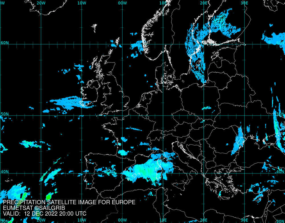
europe_precipitation_450.gif
2022-12-13 09:11
314K
europe_precipitation.gif
2022-12-13 09:11
3.6M
europe_precipitation.kmz
2022-12-13 09:11
99K
europe_precipitation.jpg
2022-12-13 09:11
133K
eumetsat_zones.txt
2021-12-13 18:32
500
filelist.txt
2020-04-13 16:41
2.8K
Apache/2.4.29 (Ubuntu) Server at gribserver.sailgrib.com Port 80